About half of the area administered by Kaohsiung City Government is mountainous, and these hilly districts offer people who love the outdoors an abundance of hiking trails and stunning vistas. This article will introduce two popular spots ideal for taking selfies: Longtoushan Hiking Trail in Maolin District and Banpingshan Park, closer to the downtown. At both, hikers can walk on carefully constructed trails through lush forest, and enjoy a getaway from the bustling city.
※Longtoushan Hiking Trail
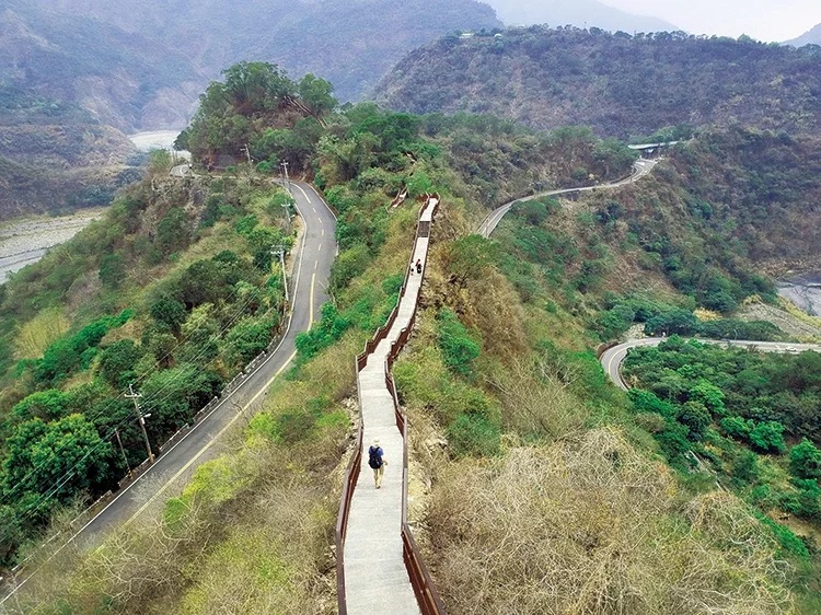
Longtoushan (Dragon Head Mountain) has long been one of the south's must-visits. Centuries of the Jhuokou Creek eroding fragile rock layers has resulted in a circular hill around which the waterway bends.
Surrounded by mountains on three sides, Longtoushan Hiking Trail offers travelers panoramic views that include Longtoushan, Shetoushan (Snake Head Mountain), and a pavilion located on the spine of Longtoushan. Along the way, outsiders can appreciate the indigenous Austronesian culture of the Rukai tribe. Motifs of the hundred-pacer snake, the Rukai's guardian spirit, appear on totems and other places.
To get to Longtoushan, Maolin National Scenic Area Administration recommends taking Kaohsiung Rural Route No. 132 into Maolin District, then heading to Duona Suspension Bridge, which is approximately 1km from Longtoushan Hiking Trail. It is an easy downhill walk from the suspension bridge to the hiking trail, and the trail itself is just 0.5km in length. An hour is enough to explore it on foot.
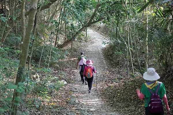
Along the trail, hikers can see rhombus shapes, symbols of the Rukai people. Depictions of lilies — the tribe's flower — are expressions of the district's rich culture.
※Banpingshan Park's Viewing Platform
Banpingshan Park, part of Shoushan National Nature Park, straddles the border between Zuoying District and Nanzih District. From Banpingshan's trails, hikers can look southward to Lotus Pond and the sights that surround that body of water, such as the Spring and Autumn Pavilions, the Dragon and Tiger Pagodas, Confucius Temple, and Old Walled City of Zuoying. If they look westward, they will see the National Stadium (which served as a key venue for the 2009 World Games) and, off in the distance, the Taiwan Strait.
Banping Lake Wetland Park is southeast of Banpingshan. With Lotus Pond and Jhouzih Wetland Park, Banpingshan's wetland forms a wetland corridor in the northern part of Kaohsiung's urban core.
Banpingshan Park offers both short and mid-length hiking trails to satisfy visitors' needs for exercise. The shorter trail is about 2.5km long. Its entrance is on Cueihua Road, near the Wan Clan Ancestral Shrine, and it provides access to a viewing platform. The longer trail is around 4km in length, and two hours is needed for a round-trip hike. Sights along the way include leafy banyan trees, uplifted coral reefs, and old military structures. Whichever route they take, hikers can immerse themselves in nature and relish true relaxation.
|